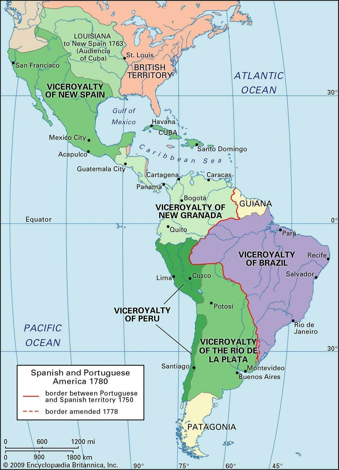
I came across this map of Spanish viceroyalties (link no longer available) a few months ago, and since it can be difficult to find good maps online I thought I'd post it here. Even though there's a plethora of maps on the Internet, it still seems like the best ones are either overhead-projector transparencies, or printed in books. This map is of Spanish territory in the Americas during the eighteenth century – it covers all of Latin America and the Spanish-American colonial empire, as well as neighboring British territory, and the Portuguese viceroyalty of Brazil.
The Spanish viceroyalties shown on the map are:
- Viceroyalty of New Spain
- Viceroyalty of New Granada
- Viceroyalty of Peru
- Viceroyalty of the Río de la Plata

(Revised and republished April 21st, 2025)