latin america
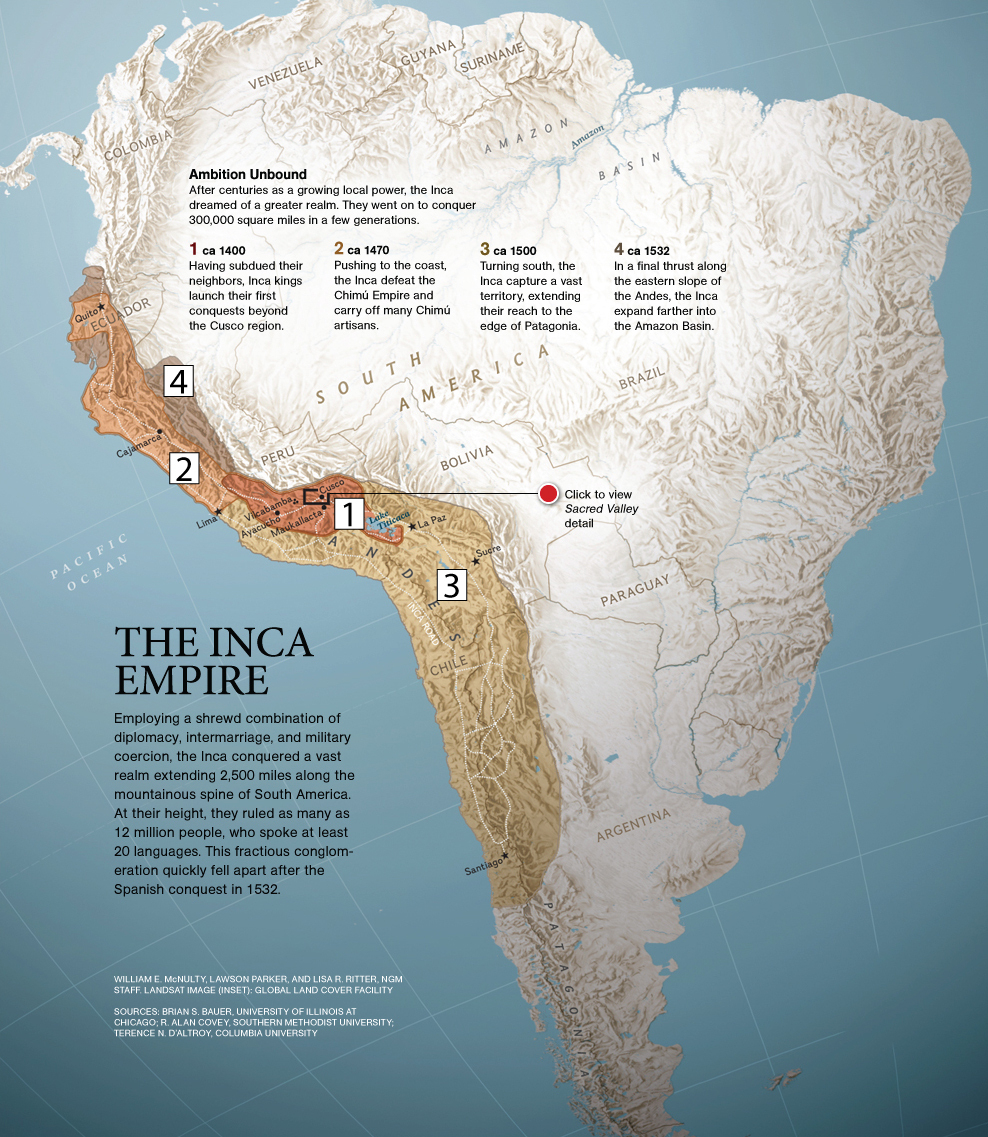
Map of the Inca Empire
This map of the Inca Empire (Wayback Machine link) is great for showing the rapid expansion of the Incas across the Andes region. On the original map it was a little difficult to correlate the numbered excerpts with the colored regions, so I made new numbers that will show up a little better on classroom projectors.

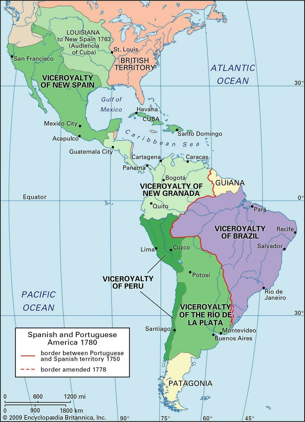
Map of Spanish Viceroyalties
I came across this map of Spanish viceroyalties (link no longer available) a few months ago, and since it can be difficult to find good maps online I thought I'd post it here. Even though there's a plethora of maps on the Internet, it still seems like the best ones are either overhead-projector transparencies, or printed in books. This map is of Spanish territory in the Americas during the eighteenth century – it covers all of Latin America and the Spanish-American colonial empire, as well as neighboring British territory, and the Portuguese viceroyalty of Brazil.
The Spanish viceroyalties shown on the map are:
- Viceroyalty of New Spain
- Viceroyalty of New Granada
- Viceroyalty of Peru
- Viceroyalty of the Río de la Plata

(Revised and republished April 21st, 2025)