Maps
Undersea Cables and Cybersecurity in Australia
Australia’s vulnerable submarine cables, by Jessica Woodall at The Australian Strategic Policy Institute
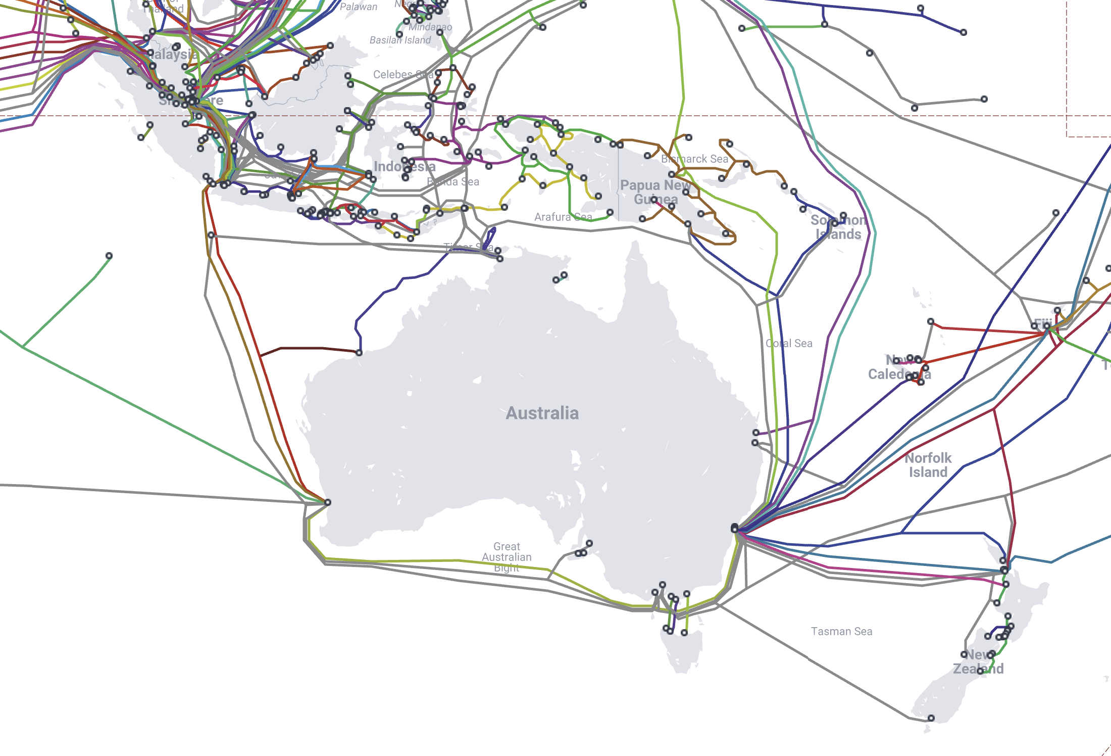
Scattered across the ocean floor in intricate webs, submarine cables transfer high data volumes between onshore nodes. Five main international cables connect Australia to cyberspace and global voice networks. They carry 99% of Australia’s total internet traffic, dwarfing the capacity of satellites. Submarine cables are vital to our communications, economic prosperity, and national security. They also tend to break. A lot.
In most regions of the world this isn’t unexpected, or particularly worrying. Submarine cables aren’t much thicker than a garden hose and for the most part sit untethered and unprotected on the sea floor. Inadvertent breakages from ship anchors, nets and natural phenomena such as undersea earthquakes occur frequently, averaging at least one a week. To mitigate this risk, international agreements between cable operating companies are extensive, repair ships are quickly deployed and traffic is usually rerouted through other cables.
Unfortunately, the situation for Australia is more complicated. Sitting in the Southern Hemisphere, we’re largely isolated from the busy network of Transatlantic and North Asian Cable lines. We’re also unable to use overland fibre optic cables from other countries, leaving us reliant upon just a handful of international undersea cables.
Image below: Australian submarine cables at submarinecablemap.com

(Revised and republished April 12th, 2025)
Sea Monsters and Submarine Cables
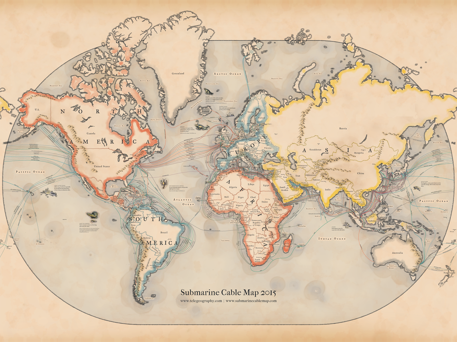
Vintage-style map of submarine cables by TeleGeography (Wayback Machine link).
This year’s map pays tribute to the pioneering mapmakers of the Age of Discovery, incorporating elements of medieval and renaissance cartography. In addition to serving as navigational aids, maps from this era were highly sought-after works of art, often adorned with fanciful illustrations of real and imagined dangers at sea. Such embellishments largely disappeared in the early 1600s, pushing modern map design into a purely functional direction.

To bring back the lost aesthetic that vanished along with these whimsical details, TeleGeography referenced a variety of resources in the design process. One of the most invaluable was Chet Van Duzer’s Sea Monsters in Medieval and Renaissance Maps book, which provides arguably the most complete history of the evolution of sea monsters and map design from this period. Our final product is a view of the global submarine cable network seen through the lens of a bygone era.
There's an interactive online version of the map as well:
http://submarine-cable-map-2015.telegeography.com
(via Vox)
(Revised and republished April 12th, 2025)
Map of the Inca Empire
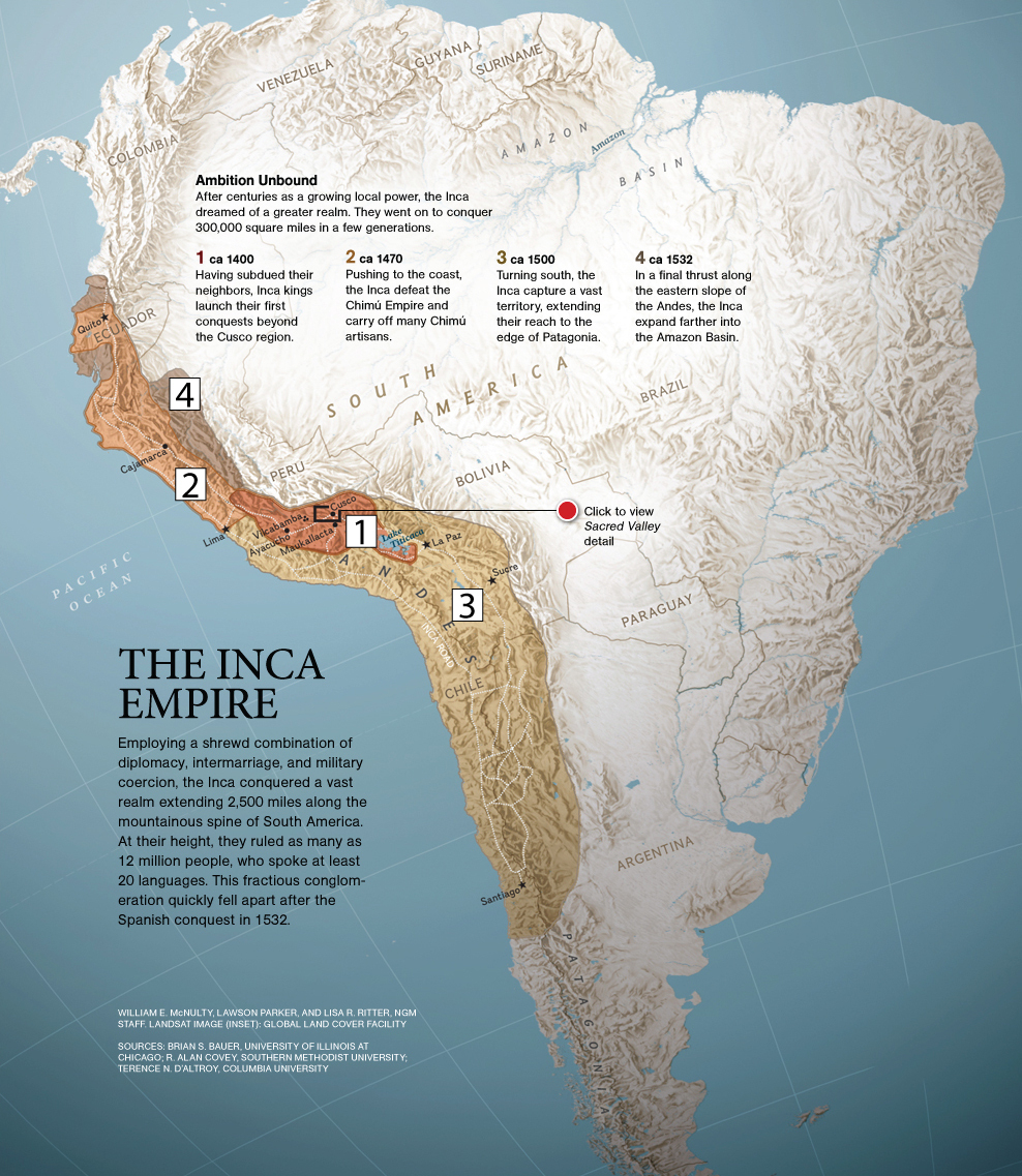
This map of the Inca Empire (Wayback Machine link) is great for showing the rapid expansion of the Incas across the Andes region. On the original map it was a little difficult to correlate the numbered excerpts with the colored regions, so I made new numbers that will show up a little better on classroom projectors.

Map of Spanish Viceroyalties
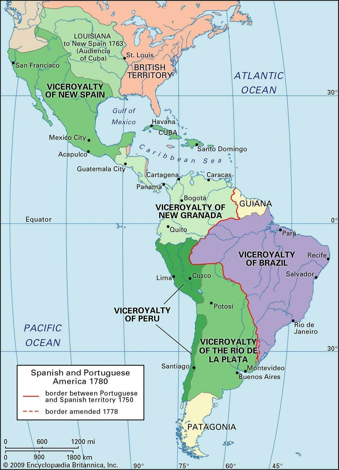
I came across this map of Spanish viceroyalties (link no longer available) a few months ago, and since it can be difficult to find good maps online I thought I'd post it here. Even though there's a plethora of maps on the Internet, it still seems like the best ones are either overhead-projector transparencies, or printed in books. This map is of Spanish territory in the Americas during the eighteenth century – it covers all of Latin America and the Spanish-American colonial empire, as well as neighboring British territory, and the Portuguese viceroyalty of Brazil.
The Spanish viceroyalties shown on the map are:
- Viceroyalty of New Spain
- Viceroyalty of New Granada
- Viceroyalty of Peru
- Viceroyalty of the Río de la Plata

(Revised and republished April 21st, 2025)